December 12, 2017; Next City
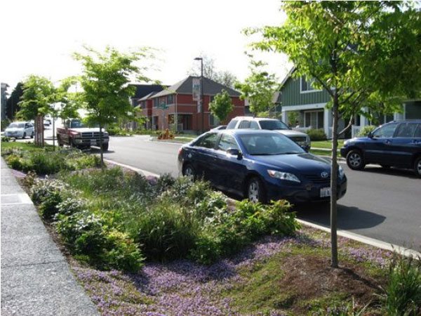
In partnership with the American Planning Association and the Low Impact Development Center, the National Recreations and Park Association (NRPA) has released a guide outlining the nuts and bolts of green stormwater infrastructure. The guide covers both physical strategies (such as stormwater-runoff collecting bioswales), as well as strategies to build public support and secure resources.
“Taken with NRPA’s other 2017 releases,” Next City’s Rachel Dovey adds, the report “reads as a call-to-arms for parks agencies that want to take on the wet, hot and increasingly unpredictable problems of a warming world in their own backyards, one flood management strategy at a time.”
The guide starts with a diagram (reproduced below) that maps the potential benefits that green stormwater strategies can deliver:

Sign up for our free newsletters
Subscribe to NPQ's newsletters to have our top stories delivered directly to your inbox.
By signing up, you agree to our privacy policy and terms of use, and to receive messages from NPQ and our partners.
In terms of technical strategies for flood management, the guide includes definitions of a host of available options. In addition to bioswales, this comprises such mechanisms as green roofs (growing vegetation on rooftops rather than having the water run off buildings), permeable pavement (has grooves to permit drainage), rain barrels (to collect stormwater run-off), and urban tree canopy (which slows stormwater by intercepting rainfall in trees and branches), among others. The report covers a number of best practice planning strategies including having a multi-disciplinary team, empowering the community, designing for equity, support public health, and planning for connectivity and accessibility.
For example, with respect to equity, the NRPA guide recommends:
- Develop and incorporate levels of service standards that encourage equitable access to parks when siting projects.
- Ensure that community outreach efforts involve all stakeholders, making efforts to include groups that have historically been underrepresented and underserved. Create a participatory process as much as possible.
- Accommodate as many ages, abilities, activity levels, and amenities as possible given site constraints; plan for a diversity of uses and users, according to community needs.
The guide also contains a helpful list of community engagement strategies that include:
- Engage the community through operational staff who interact with the community daily (via comment boxes, conversations).
- Identify an individual, individuals, or organization to lead efforts to organize stakeholders—a “local champion committed to improving a neighborhood, city, or region’s quality of life and sustainability”
- Set a regular meeting schedule to keep stakeholders informed of the progress.
- Utilize tools such as formalized policies and frameworks for engagement to guide outreach in an inclusive direction and keep the design adaptive.
- Use visuals and key messaging to frame the conversation.
- Provide data and explain project benefits and the perceived and real drawbacks in a way the community understands so that they can make informed decisions.
- Hold meetings at times and places that make it possible for all members of the community to participate.
- Form partnerships to maintain momentum for the plan during a long implementation period.
- Utilize various ways to engage stakeholders, including charrettes and town meetings, to ensure different viewpoints are incorporated and projects provide long-term benefits such as jobs and volunteer opportunities.
- Consider upfront how to address language barriers, communication issues, cultural barriers, or seemingly irreconcilable differences of opinion.
- Consider the possibility of gentrification and involve partners such as the local Housing Authority to take necessary measures to maintain the community.
The report provides a couple of examples of implementing this community-based approach. For example, in New York City, the Municipal Art Society of New York has created an interactive map of underused land. “This tool, the report authors note, “makes it easy for anyone to see where there is potential for land to be repurposed, and whether it is located within a floodplain, in an underserved area, or in a low-income community.” The report authors add that, “Making this information publicly available in a user-friendly format can help small organizations and individual residents become more educated and engaged about land use issues in their own communities.”
“Parks are a smart and effective solution to many of the challenges associated with a changing climate,” notes Lori Robertson, NRPA director of conservation. “Our hope is more communities will discover these benefits through the use of this guide, and the implementation of green stormwater infrastructure projects in parks across the country.”—Steve Dubb


