October 23, 2017; Science Daily
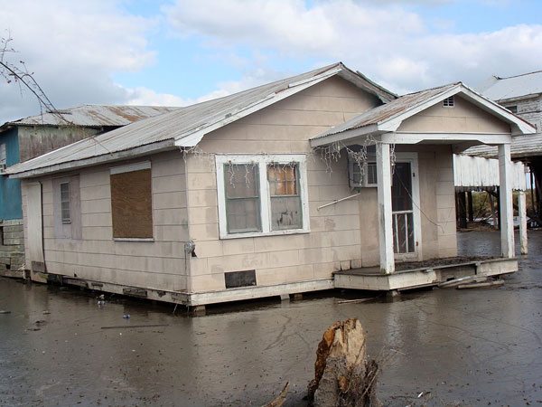
The home of the Biloxi-Chitimacha-Choctaw Indians is shrinking. Dulac, Louisiana, 17 miles from the coast, has become a group of land dots in the water as sea levels rise to create a Swiss-cheese topography. According to Barry Yeoman at The Fern, “The U.S. Geological Survey said the larger Terrebonne Basin lost almost 30 percent of its land from 1932 to 2010.”
The reason for the change is apparent: Humans have rerouted the Mississippi River, carved canals in the delta, and drilled for oil and gas off the coast of Louisiana. Where there were fields and forests when the senior tribe members were children, there is now water. They must use boats where they used to run. Their heritage land, including their dead ancestors, has sunk. The area floods regularly, and the coffins have been floating away.
Chief Shirell Parfait-Dardar of the Grand Caillou/Dulac Band of the Native American indigenous tribe says, “This took a long time to evolve. It’s gotten so bad there is no way to repair it.”
“It can be a bit deceiving. It’s absolutely beautiful here,” she added. “You can still see some trees in spots. But I’m on a sliver of land. Everything has changed.”
The Geological Society of America presented the story about the shrinking Mississippi Delta land and its residents at their annual meeting in Seattle last month. The mission of the nonprofit is “to advance geoscience research and discovery, service to society, stewardship of Earth, and the geosciences profession.” Williams College Chair and professor for Geoscience Rónadh Cox presented the study, which she coauthored with Parfait-Dardar, for the Geological Society. Cox’s students have visited Dulac and studied the predicament of the Grand Caillou/Dulac Band of Biloxi-Chitimacha-Choctaw Indians in time spent with Chief Parfait-Dardar.
Sign up for our free newsletters
Subscribe to NPQ's newsletters to have our top stories delivered directly to your inbox.
By signing up, you agree to our privacy policy and terms of use, and to receive messages from NPQ and our partners.
The community has been losing land at an average of 1 percent per year between 1974 and 1990, according to previous research. A more recent analysis shows that subsidence rates in the Dulac area average 12.5 millimeters (one-half inch) per year—among the highest in southern Louisiana.
“Younger people, they get out. They have to survive,” she said. But that survival comes at a high cost. “We’re losing our culture and our people. You don’t just lose your home, you lose who you are.”
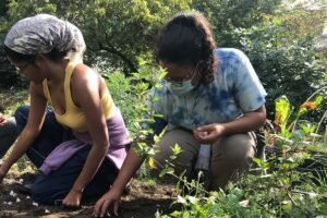
Parfait-Dardar and others are trying to make it work, experimenting with new crops and farming techniques. According to Yeoman, “She heads an intertribal effort to restore food sovereignty—the sustainable production of healthy and culturally appropriate food—to a half-dozen of Louisiana’s Native American communities.”
Moving from the land of one’s ancestors is difficult and often impossible financially for many members of the community. Many homes have been lifted off the ground on pillars up to 20 feet high. It is difficult for the elders to navigate the elevated structures, and some have not been able to afford to lift their homes. Some homes have already been abandoned.
Other Native American communities affected by the sea-level rise include those who can only access their homes by boat, the Grand Bayou Atakapa tribe and the Inuit of Alaska, whom NPQ has covered previously. The first “climate refugees” in the US may be the Isle de Jean Charles band of the Biloxi-Chitimacha-Choctaw, who are presently undergoing federal resettlement.—Marian Conway


